


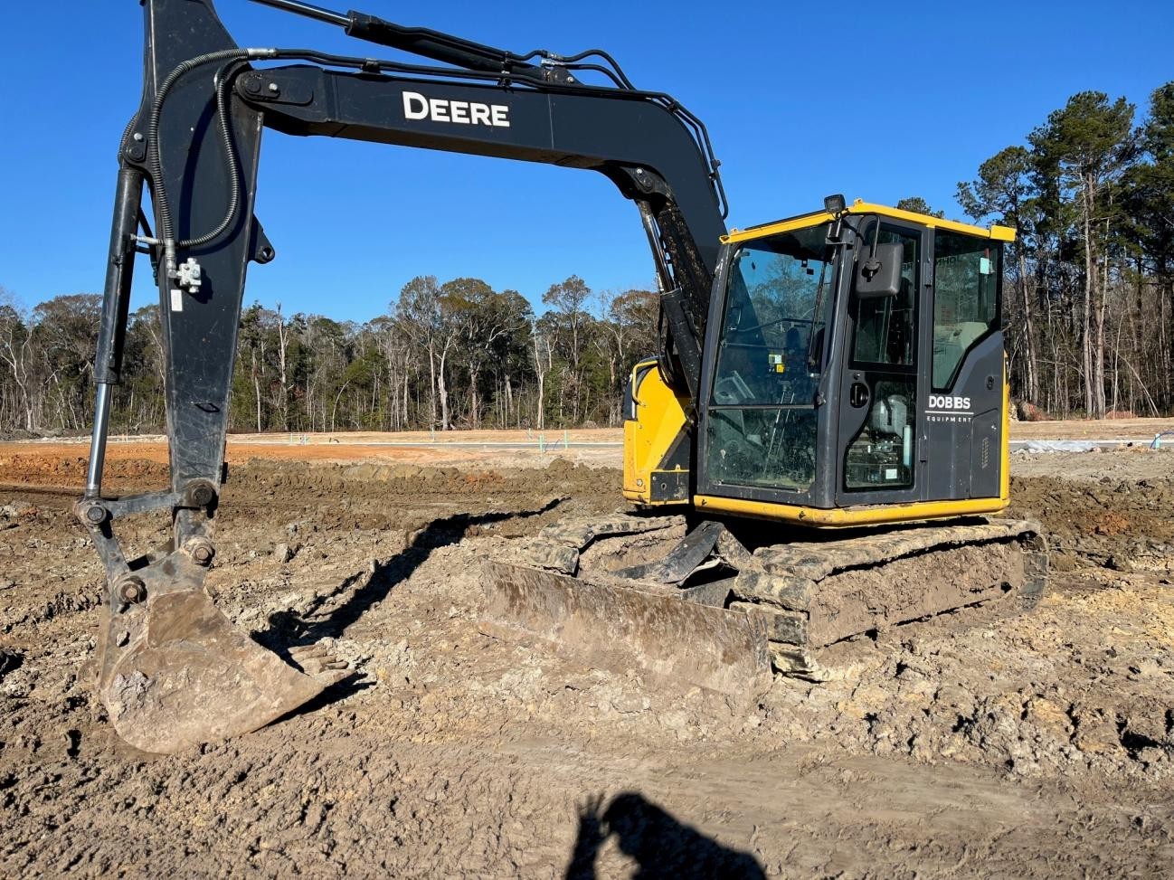
For decades, survey work depended on people walking sites with tools and notebooks. Crews measured land by hand, marked points, and returned many times to confirm details. This approach worked, but it was slow and often risky. In road construction, early survey mistakes frequently led to design changes and delays later in the project.
Today, drones offer a practical shift. They fly above the site and capture details that are difficult to see from the ground. Accuracy matters because roads must meet strict design requirements. Speed matters because timelines are tight. Cost matters because overruns affect everyone involved. These needs are pushing survey methods to change.
What Are Drone-Based Road Construction Surveys?
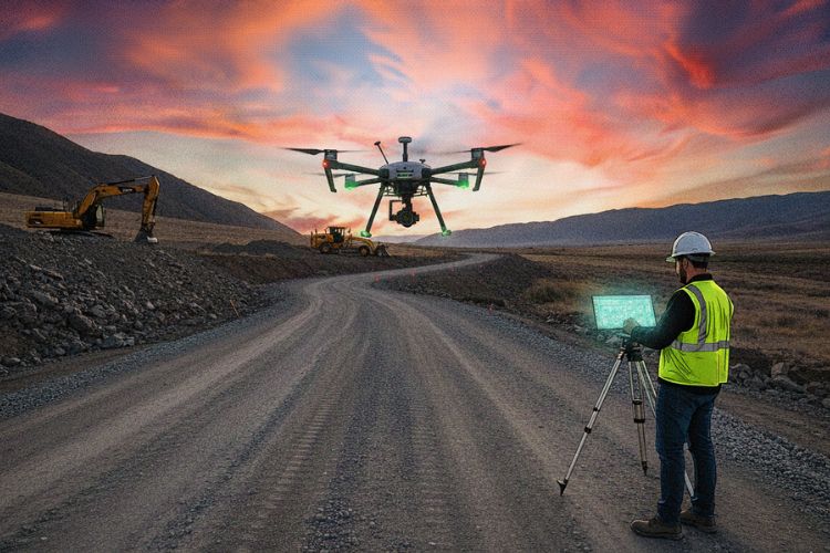
Drone-based surveys use unmanned aircraft to collect site data from the air. A construction drone survey captures images and location points while following a planned flight path. The drone records photos, elevation data, and surface details across the site.
This data is processed into maps and models that clearly represent the land. Unlike ground surveys, drones can cover wide areas in a single flight. They also reduce the need for surveyors to work close to traffic or unstable ground. This difference has changed how many teams approach construction on roads.
Types Of Drones Used In Road Construction Projects
Road construction projects vary in size, layout, and level of detail required. Because of this, no single drone fits every job. Survey teams choose different types of drones based on distance, terrain, and the type of data needed. The most common options include fixed-wing drones for long routes, multirotor drones for close inspections, and specialized sensors that collect accurate survey data.
- Fixed-Wing Drones For Long Road Corridors
Fixed-wing drones are ideal for surveying long road corridors. They fly faster and stay in the air longer than other types, which allows them to cover large areas in a single flight. This makes them useful for early planning and alignment studies.
- Multirotor Drones For Detailed Site Inspections
For in-depth inspections, multirotor drones are more appropriate. At intersections, bridges, and construction zones, where accuracy is crucial, their ability to hover in place and move slowly aids in the collection of precise data.
- Sensors And Cameras Used On Survey Drones
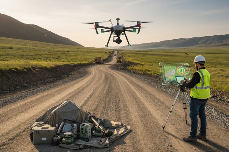
Survey drones are equipped with high-quality cameras and sensors. RGB cameras capture clear visual images, while LiDAR sensors measure depth and elevation. Together, these tools support construction drone mapping that meets engineering and planning standards.
How Drones Improve Survey Accuracy In Road Construction?
Accuracy starts with clear imagery. High-resolution images of surface variations, slopes, and alignment problems are taken by drones. Every image is linked to exact coordinates by GPS and RTK systems. The photos are then transformed into precise, quantifiable models using photogrammetry software.
This process reduces human error. Surveyors no longer rely only on manual notes or limited sight lines. In road construction, small measurement errors can lead to serious problems later. Drone surveying for construction helps reduce that risk.
Time Saving Benefits Of Using Drones For Road Surveys
Time is often the biggest pressure on infrastructure projects. Manual surveys can take days or even weeks, especially on large sites. Drones collect the same data in a matter of hours. One flight can cover areas that once required several survey crews.
Hard-to-reach locations are also easier to survey. Steep slopes, water crossings, and active traffic lanes no longer slow progress. Faster data processing allows teams to review results sooner. That speed helps keep construction on roads moving forward.
How Drones Reduce Survey Expenses?
Faster work usually leads to lower costs. Drones reduce labor requirements and limit the need for heavy equipment. Fewer site visits also lower fuel and travel expenses. Re-surveys are less common because the initial data is more complete.
Over time, these savings add up. Large projects benefit the most since surveys are repeated at several stages. In road construction, better data early can prevent expensive redesigns later.
Enhancing Safety On Road Construction Sites With Drones
Surveying near traffic is dangerous. Workers face moving vehicles, uneven surfaces, and heavy machinery. Drones reduce exposure by keeping survey teams off the roadway.
They also make it safer to inspect unstable areas. Slopes, embankments, and excavation zones can be reviewed from above. Drone construction monitoring allows teams to observe active sites without stopping work or putting staff at risk.
Key Applications Of Drones In Road Construction Surveys
Drones support many tasks throughout a project. During planning, they assist with route selection and feasibility studies. Topographic mapping reveals elevation changes and drainage patterns. Earthwork volumes are measured by comparing site models over time.
Progress tracking is another important use. Drone construction monitoring shows how work advances week by week. Quality checks become easier when visual records are available.
Using Drone Data For Better Project Planning And Decision Making
Drone data is transformed into 3D models and digital maps. These visuals help engineers understand site conditions more clearly. Design teams can test ideas using real data instead of assumptions.
Clear visuals also improve communication. Clients, inspectors, and field crews see the same information. This shared understanding reduces confusion. In road construction, better alignment leads to faster and more confident decisions.
Environmental And Regulatory Advantages Of Drone Surveys
Drone surveys disturb the land less than traditional methods. Crews do not need to clear paths or place as many ground markers. This helps protect vegetation and nearby habitats.
Documentation also improves. Survey records support permit applications and inspections. Construction drone mapping provides consistent data that meets modern standards and simplifies audits.
Challenges And Limitations Of Using Drones In Road Surveys
Drones still have limitations. Weather can delay flights, and wind or rain can affect data quality. Regulations may restrict airspace or require special approvals.
Data processing also requires skill. Teams must know how to manage and analyze large data files. Drone surveying for construction works best when trained operators handle both flight operations and data analysis.
How Drones Will Shape Road Construction Surveys?
Technology continues to improve. Artificial intelligence will help analyze survey data faster. Automation may allow near real-time updates from the field.
As systems integrate with design software, survey data will flow directly into planning tools. Construction drone mapping is likely to become standard practice across projects of all sizes.
Final Words
Drones have changed how surveys are performed. They improve accuracy, save time, and reduce risk. In road construction, these benefits matter at every stage of a project.
Construction on roads will continue to demand better data and safer methods. Drone tools meet these needs without adding unnecessary complexity. Many road construction contractors already rely on them as part of their daily operations.
Drone construction monitoring and a construction drone survey approach support smarter planning and smoother delivery. As adoption grows, drone surveying for construction will continue shaping how roads are designed, built, and maintained.
If you are serious about building with the right people, Contractor Guy Network gives you a place to start. Connect with verified specialists, trusted partners, and real opportunities designed for construction professionals.

